
PROTECT YOUR DNA WITH QUANTUM TECHNOLOGY
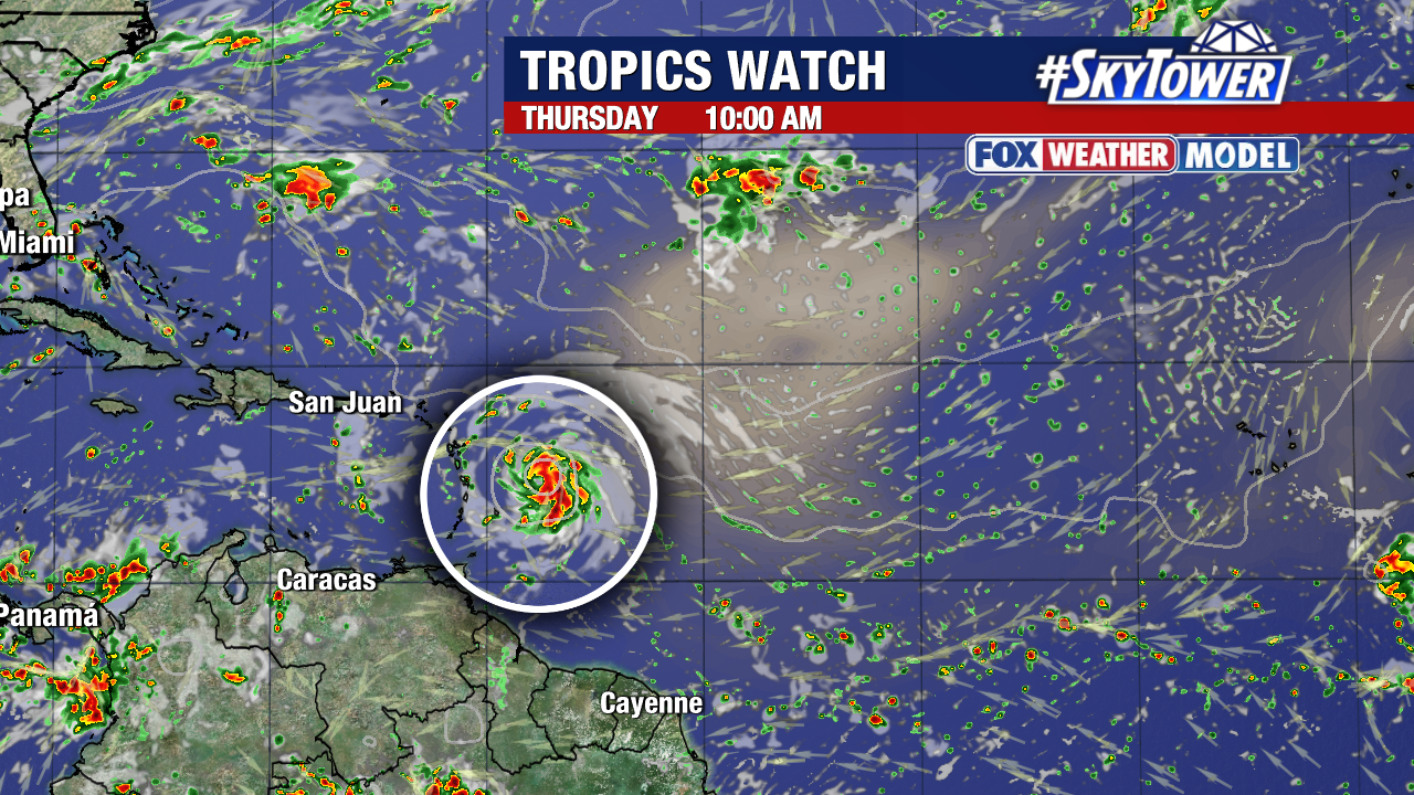
Orgo-Life the new way to the future Advertising by AdpathwayThere are two areas flagged for tropical development: Invest 95L in the Central Atlantic and an area in the SW Gulf.

Invest 95L is about 1,000 miles east of the Windward Islands and is on the way to becoming a tropical depression or next named storm of the season.
The low pressure area started as a tropical wave off the coast of Africa and has been getting organized the last few days.

Invest 95L is moving at a quick pace towards the west-northwest and will be near or just north of the Leeward Islands Thursday-Friday.

The trends favor a curve to the north well east of the U.S. but there is still questions in when exactly that will occur.
There is a cluster of models that remain east of Bermuda but some that trend south and bring more implications for Puerto Rico and some of the islands.
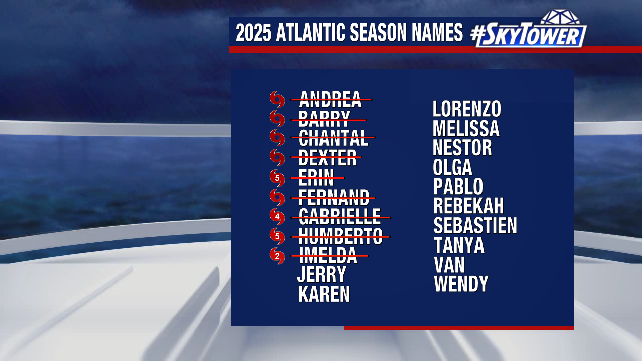
Jerry is the next name in line. Here’s where we stand so far with a total of four hurricanes:
The other area to watch for tropical development is in the SW Gulf. The odds are low at only 10% in the next 7 days.
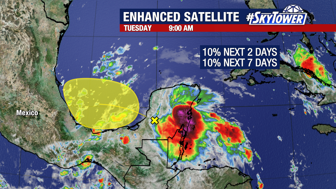
A disorganized area of thunderstorms could slowly develop as it moves across the Yucatán Peninsula and into the Bay of Campeche through Wednesday.


.gif)


 English (US) ·
  French (CA) ·