
 3 months ago
79
3 months ago
79
PROTECT YOUR DNA WITH QUANTUM TECHNOLOGY
Orgo-Life the new way to the future Advertising by AdpathwayDisclaimer: This site is not affiliated with the National Hurricane Center, Hurricane Hunters, Storm Prediction Center, or National Weather Service. ALL forecasts herein are the result of my analysis, (to which you will see me at times, insert excerpts from various agencies due to the nature of the importance of the information) and I am solely responsible for the content. As ALWAYS, follow the National Hurricane Center, National Weather Service, and your local Emergency Management officials for emergency decisions. In addition, this is strictly a FORECAST OFFICE. I CANNOT make decisions regarding travel plans, etc. My purpose, is to provide you the information, based solely on information I analyze, and the accuracy of the information at hand of the time of analysis, so you may make informed decisions.
(T. F. “Storm” Walsh)
Thanks to all of you that still follow my forecasts. I truly appreciate each and every one of you!
For those who have donated to my site, your help has been greatly appreciated. If you are not aware, donations to my site help pay for subscriptions to sites I use as well as software updates, which provide all the models and information used in my forecasts. To donate, please click the DONATE button to the right side of the page, or on the graphic of the dog. Any help you provide is immensely appreciated!
DONATIONS NEEDED AND APPRECIATED


I will reiterate, my forecasts are based on the available information at the time of analysis, and are only as accurate as the information analyzed and the solutions provided.
Good day everyone!
As of this morning, the Storm Prediction Center does not indicate any severe weather probabilities for the week. However, the current discussion indicates a low probability that a low severe threat could be introduced as we get closer to the weekend:
SPC DAYS 4 – 6 FORECAST DISCUSSION
…Days 4-6/Fri-Sun — TX into the Southeast…
An upper trough is forecast to spread eastward from the Southwest into the Southeast Days 4-6/Fri-Sun. Beginning on Day 4/Friday, southwesterly flow will overspread the southern Plains ahead of the trough and surface low pressure is expected to develop over western TX. As the system spreads east through the weekend, Gulf moisture (upper 50s to low 60s F dewpoints) will overspread much of central to eastern TX toward the Lower MS Valley and Deep South. Some model spread persists with regards to the timing of eastward progression of the upper trough, and exact latitude of the surface low (some guidance clustering further south, other guidance a bit further north), which will impact quality of moisture return. Regardless, at least weak destabilization should accompany boundary layer moistening and cooling aloft amid strengthening deep-layer southwesterly flow.
Some low-end severe potential is possible from Friday evening through Saturday across portions of TX, and into the Lower MS Valley/Deep South Saturday night through Sunday. However, overall severe potential will likely be limited by weak destabilization, a somewhat cool boundary layer, and questionable moisture return this early in the season, precluding 15 percent severe delineation.
..Leitman.. 02/10/2026
STORM PREDICTION CENTER (SPC) DAY 5 SEVERE WEATHER OUTLOOK (LINKED)
 The CSU – MLP and CIPS ML ANALOG severe weather guidance forecast does however suggest a possibility for a SLIGHT risk by Sat. FEB. 14. The NSSL ML forecast map was not available. It is also noted that the CSU – MLP severe guidance has suggested a MARGINAL risk for days 4 and 6. Since Sat. has the higher probability at the moment, it will be the focus of this synopsis. I will continue to monitor the updates of these models and the SPC outlooks for any changes, and should a severe threat be introduced by the SPC, more detailed synopses will be issued.
Information obtained in limited analysis this morning was derived from the 00Z GFS model run. As the NAM 3KM comes into the forecast period which only goes out to 60 hours, I should have more accurate information as far as forecast parameters to utilize in any updates.
CSU – MLP / CIPS ANALOG DAY 5 SEVERE WEATHER FORECAST MAPS (CSU – MLP LINKED FOR LARGER IMAGES)

 CSU – MLP 6 PANEL FORECAST PROBABILITIES (LINKED)

Given that a limited analysis was only able to be conducted, and the GFS does not have the higher resolution of the NAM 3KM, the following should not be considered absolute as guidance will most likely change over the next few days.
Analysis of the 00Z run of the GFS models current severe indices and parameters indicates at the moment to potential for a MARGINAL to MODERATELY unstable atmosphere on Sat. Veering winds with height should be present (vorticity will be present) and from the following directions at the various levels (with 10m being at the surface, and 250 mb at the jetstream level):
10m = SSW
850 mb = WSW
500 mb = SW
250 mb = W
The model also indicated deep layer shear of 50 – 70 kts, SBCAPE of 500 – 1250 J/kg-1, MLCAPE of 250 – 750 J/kg-1, Moderate mid level lapse rate of 6.5 – 7.5 C/km-1, Lifted Indices of -2 to -5, EHI 0.4 – 1.8, 0 – 3km SRH 100 – 300, and Craven – Brooks significant severe parameter of 10,000 – 20,000. Dew Points are currently forecast to be in the mid 50’s to mid to upper 60’s
GFS DEW POINT FORECAST

This current forecast setup could suggest isolated weak tornado activity and possible hail with stronger cells, should they develop.
The following is a list of severe weather parameters and indices:
CAPE

ENERGY HELICITY INDEX

K INDEX

TOTAL TOTALS INDEX

STORM RELATIVE HELICITY

LIFTED INDEX

SWEAT VALUES

THOMPSON INDEX

Craven SigSvr Parameter:
The simple product of 100mb MLCAPE and 0-6km magnitude of the vector difference (m/s; often referred to as “deep layer shear”) accounts for the compensation between instability and shear magnitude. Using a database of about 60,000 soundings, the majority of significant severe events (2+ inch hail, 65+ knot winds, F2+ tornadoes) occur when the product exceeds 20,000 m3/s3.

Again, I will be monitoring the situation over the next few days and will make the appropriate changes as warranted.
The following NWS Watch / Warning map will provide local NWS information for your area. Click the image, then once it refreshes, click on your area of interest to view forecasts, any special weather statements, hazards or advisories for your area.
NWS WATCH / WARNING DISPLAY (LINKED…CLICK MAP, THEN YOUR AREA) NWS DOPPLER RADAR LOOP (LINKED, CLICK RADAR MAP)
 RAP RADAR (CLICK IMAGE THEN GO TO LOOP DURATION AND PICK LENGTH OF LOOP, THEN CLICK RADAR SITE)
 WUNDERGROUND RADAR SUMMARY MAP (CLICK FOR UPDATES)
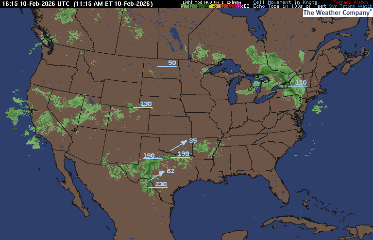
PRECIPITATION TYPE (CLICK TO ACCESS ANIMATION FEATURE) CARIBBEAN RADAR (CLICK IMAGE)
 You may direct any questions by contacting me personally, ANYTIME, at: twalsh22000@yahoo.com
Have a blessed day!
T. F. “STORM” WALSH III
GMCS, USCG (ret)
METEOROLOGIST / HURRICANE SPECIALIST /SEVERE WEATHER SPECIALIST


 English (US) ·
  French (CA) ·