
 3 months ago
92
3 months ago
92
PROTECT YOUR DNA WITH QUANTUM TECHNOLOGY
Orgo-Life the new way to the future Advertising by AdpathwayDisclaimer: This site is not affiliated with the National Hurricane Center, Hurricane Hunters, Storm Prediction Center, or National Weather Service. ALL forecasts herein are the result of my analysis, (to which you will see me at times, insert excerpts from various agencies due to the nature of the importance of the information) and I am solely responsible for the content. As ALWAYS, follow the National Hurricane Center, National Weather Service, and your local Emergency Management officials for emergency decisions. In addition, this is strictly a FORECAST OFFICE. I CANNOT make decisions regarding travel plans, etc. My purpose, is to provide you the information, based solely on information I analyze, and the accuracy of the information at hand of the time of analysis, so you may make informed decisions.
(T. F. “Storm” Walsh)
For those who have donated to my site, your help has been greatly appreciated. If you are not aware, donations to my site help pay for subscriptions to sites I use as well as software updates, which provide all the models and information used in my forecasts. To donate, please click the DONATE button to the right side of the page, or on the graphic of the dog. Any help you provide is immensely appreciated!
DONATIONS ACCEPTED AND APPRECIATED


I will reiterate, my forecasts are based on the available information at the time of analysis, and are only as accurate as the information analyzed and the solutions provided.
Good day everyone!
Just to reiterate, though some of my forecasts may not directly apply to you or your particular weather group, I have no idea where your families or friends reside, and this is the reason you may receive the forecasts.
The Storm Prediction Center (SPC) has issued a SLIGHT risk for severe thunderstorms in the current DAY 3 Outlook: THURSDAY AFTERNOON INTO EARLY EVENING ACROSS PARTS OF CENTRAL AND SOUTHERN ILLINOIS…SOUTHERN INDIANA…WESTERN/NORTHERN KENTUCKY…AND SOUTHWESTERN OHIO…
…SPC SUMMARY…
Severe thunderstorms with potential to produce a few tornadoes and damaging wind gusts are possible across parts of the middle Mississippi into lower Ohio Valleys Thursday afternoon into early evening.
SPC DAY 3 SEVERE THUNDERSTORM OUTLOOK (LINKED FOR OUTLOOK TEXT)

The following is the day 3 severe probability from the CSU – MLP severe weather forecast map vs the SPC forecast, and the NSSL ML DAY 3 severe probability.
CSU – MLP DAY 3 FORECAST (CLICK FOR LARGER IMAGE)
NSSL DAY 3 SEVERE FORECAST PROBABILITY (LINKED FOR INTERACTIVE MAP)

DAY 3 PROBABILITY CONVERSION TABLE
SPC DISCUSSION EXCERPT:
…Middle Mississippi/Lower Ohio Valley…
Latest model output continues to indicate better low-level moisture return (but still marginal for severe convective development) to portions of the warm sector of the developing cyclone as it migrates across and northeast of the lower Missouri Valley Thursday afternoon. It appears that this may include a corridor of mid 50s to near 60F surface dew points advecting northeast and east of the confluence of the Mississippi and Ohio Rivers. However, it now appears that much of this moistening may occur beneath relatively warm mid/upper levels, associated with subsidence to the south of the upper jet axis.
This is not reflected in the latest RRFS forecast soundings, which indicate rather potent thermodynamic profiles evolving by Thursday afternoon across the lower Ohio Valley vicinity, in terms of both conditional and convective instability. A general consensus of other model output suggests the development of much more modest CAPE. This includes NAM forecast soundings, which depict CAPE at or below 500 J/kg where the low-level moistening occurs, mostly due to low equilibrium levels below the 500 mb level. It remains unclear if this environment will become supportive of convection capable of producing lightning.
Even so, NAM forecast soundings still depict boundary-layer based CAPE supportive of low-topped convection which could acquire supercellular structure in the presence of strong cloud bearing shear. Aided by the evolution of sizable clockwise-curved low-level hodographs beneath 30-50 kt southerly 850 mb flow, and a relatively moist boundary-layer with steep lapse rates, a few tornadoes appear possible, in addition to small to marginally severe hail. The evolution of a small organizing cluster may still not be out of the question, which probably would be accompanied by better potential for damaging surface gusts.
Based on analysis of some limited, preliminary severe forecast indices and parameters this morning, the forecast is somewhat perplexing in that the atmosphere is currently forecast to be marginally unstable, however the probability for tornadoes and possible small to marginally severe hail is mentioned by the SPC. The SPC mentions the forecast of steep lapse rates, however the current forecast mid level lapse rates does not support this at the moment. Forecast lifted indices also suggest a marginally unstable atmosphere. The following are the analyzed indices from this morning:
SBCAPE: 250- 500 j/kg-1
SRH 0 -3 km: 300 – 400 m2/s2
L. I.: 0 to -2
0 -6 km SHEAR: 80 kts – 90 kts
MID LEVEL LAPSE RATE: 6.0C – 6.5C
DEWPOINT: 55F – 60F
CRAVEN – BROOKS INDEX: 5,000 – 10,000
The only thing that comes to mind at the moment is, tornadoes may be possible, given the forecast 0 – 3km SRH values, and 0 – 6km (bulk) wind shear values. Another value used in a reduced buoyancy state of atmosphere is SHERB and EFFECTIVE SHERB.
SHERB
(Severe Hazards in Environments with Reduced Buoyancy) is a forecasting parameter that combines 0-3 km shear, low-level lapse rates, and 700-500 hPa lapse rates to predict severe weather in High-Shear/Low-CAPE (HSLC) environments. A SHERB value indicates increased potential for significant severe weather (EF2+ tornadoes, 65+ knot winds)
SHERB (Original): Developed to identify severe, often linear, convective storms (like QLCS) where traditional instability (CAPE) is low, focusing on high shear and steep lapse rates.
Effective SHERB (SHERBE/SHERBS3): Uses the same components as SHERB (0-3 km shear, lapse rates) but filters the results to ensure they are relevant to the actual storm inflow layer (from “Effective Inflow Base” to “Most Unstable Parcel EL height”) rather than just a fixed altitude.
The current forecast values of ESHERB within the forecast SLIGHT risk outline were analyzed to be 1.0 – 1.2.
ESHERB FORECAST VALUES
ALL values this early in the forecast period should not be taken as absolute, and should be used only for a general idea of what could occur.
Elsewhere, though the SPC has not indicated any further severe weather risks, the ML SEVERE modeling has indicated the probability of a MARGINAL severe risk for DAY 4. MLP (Machine Learning Probabilities) should not be taken as absolute, but just as an awareness product based on lack of any further outlooks.
CSU – MLP AND NSSL ML DAY 4 SEVERE WEATHER PROBABILITY FORECAST (CLICK FOR LARGER IMAGE)

NADOCAST forecast maps will not be available as they are only issued for Day 1 severe weather events.
I will continue to monitor the situation for any changes to the SPC outlooks and will try to update information as warranted.
The following links will connect you to the Excessive Rainfall probabilities and River Flood Outlook:
EXCESSIVE RAINFALL
https://www.wpc.ncep.noaa.gov/qpf/excessive_rainfall_outlook_ero.php
SIGNIFICANT RIVER FLOOD OUTLOOK
https://www.wpc.ncep.noaa.gov/nationalfloodoutlook/index.html
The following NWS Watch / Warning map will provide local NWS information for your area. Click the image, then once it refreshes, click on your area of interest to view forecasts, any special weather statements, hazards or advisories for your area.
NWS WATCH / WARNING DISPLAY (LINKED…CLICK MAP, THEN YOUR AREA)
NWS DOPPLER RADAR LOOP (LINKED, CLICK RADAR MAP)
RAP RADAR (CLICK IMAGE THEN GO TO LOOP DURATION AND PICK LENGTH OF LOOP, THEN CLICK RADAR SITE)
WUNDERGROUND RADAR SUMMARY MAP (CLICK FOR UPDATES)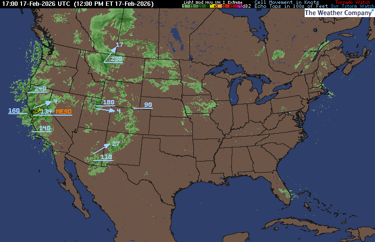
PRECIPITATION TYPE (CLICK TO ACCESS ANIMATION FEATURE)
CARIBBEAN RADAR (CLICK IMAGE TO ACCESS ANIMATION)
You may direct any questions by contacting me personally, ANYTIME, at: twalsh22000@yahoo.com
Have a blessed day!
T. F. “STORM” WALSH III
GMCS, USCG (ret)
METEOROLOGIST / HURRICANE SPECIALIST /SEVERE WEATHER SPECIALIST


.gif)


 English (US) ·
  French (CA) ·