
 3 months ago
79
3 months ago
79
PROTECT YOUR DNA WITH QUANTUM TECHNOLOGY
Orgo-Life the new way to the future Advertising by AdpathwayDisclaimer: This site is not affiliated with the National Hurricane Center, Hurricane Hunters, Storm Prediction Center, or National Weather Service. ALL forecasts herein are the result of my analysis, (to which you will see me at times, insert excerpts from various agencies due to the nature of the importance of the information) and I am solely responsible for the content. As ALWAYS, follow the National Hurricane Center, National Weather Service, and your local Emergency Management officials for emergency decisions. In addition, this is strictly a FORECAST OFFICE. I CANNOT make decisions regarding travel plans, etc. My purpose, is to provide you the information, based solely on information I analyze, and the accuracy of the information at hand of the time of analysis, so you may make informed decisions.
(T. F. “Storm” Walsh)
For those who have donated to my site, your help has been greatly appreciated. If you are not aware, donations to my site help pay for subscriptions to sites I use as well as software updates, which provide all the models and information used in my forecasts. To donate, please click the DONATE button to the right side of the page, or on the graphic of the dog. Any help you provide is immensely appreciated!
DONATIONS ACCEPTED AND APPRECIATED


I will reiterate, my forecasts are based on the available information at the time of analysis, and are only as accurate as the information analyzed and the solutions provided.
Good day everyone!
Just to reiterate, though some of my forecasts may not directly apply to you or your particular weather group, I have no idea where your families or friends reside, and this is the reason you may receive the forecasts.
The Storm Prediction Center (SPC) has issued a MARGINAL risk for severe thunderstorms in the current DAY 3 Outlook: ACROSS PORTIONS OF WESTERN TEXAS…
…SPC SUMMARY…
Isolated strong to severe thunderstorms could produce small to marginally severe hail Friday evening into the overnight hours across portions of western Texas.
SPC DAY 3 SEVERE THUNDERSTORM OUTLOOK (LINKED FOR OUTLOOK TEXT)

The following is the day 3 severe probability from the CSU – MLP severe weather forecast map vs the SPC forecast, and the NSSL ML DAY 3 severe probability.
CSU – MLP DAY 3 FORECAST (CLICK FOR LARGER IMAGE)
NSSL DAY 3 SEVERE FORECAST PROBABILITY (LINKED FOR INTERACTIVE MAP)

DAY 3 PROBABILITY CONVERSION TABLE
SPC DISCUSSION EXCERPT:
…West TX Vicinity…
Friday will begin with upper level ridging centered over the central/southern High Plains. South/southeasterly low-level flow across the western Gulf into west TX will transport modest boundary layer moisture northwestward into the Trans-Pecos/Permian Basin, and northward into the TX South Plains and Red River Valley. Meanwhile, an upper trough oriented over southern CA/northwest Mexico will steadily shift east toward the southern Rockies by early Saturday. As this occurs, the upper ridge will shift east and midlevel moistening/cooling will occur after 00z. Furthermore, deep-layer southwesterly flow will increase across western TX.
Elevated instability is expected to develop by late afternoon/early evening across the region in response to increasing moisture and cooling aloft. As large-scale ascent overspreads the southern Rockies/High Plains, scattered thunderstorms are expected to develop on the nose of a 30-40 kt southerly low-level jet. Convection will likely remain elevated given post-sunset timing and nocturnal stabilization of the boundary layer. Nevertheless, supercell wind profiles, with elongated/straight hodographs above 3km are present in forecast soundings, along with steep midlevel lapse rates. Isolated strong to severe thunderstorms could produce marginally severe hail to near 1-inch diameter during the evening/overnight hours.
Based on analysis of some limited, preliminary severe forecast indices and parameters this morning, the atmosphere is currently forecast to be marginally unstable. Though preliminary Lifted Index values (-2 t0 -4) would indicate the atmosphere to be approaching closer to a moderately unstable condition, weak SBCAPE (250 J/kg-1 – 750 J/kg-1) and MLCAPE (<250 J/kg-1 – 250 J/kg-1) indicate marginal instability.
Based on current forecast mid level lapse rates approaching steep (7.0 – 8.0 C/km-1) and the mentioned lifted indices, isolated marginally severe hail could be possible. Based on bulk shear of 60 – 80 kts, and DCAPE of 600+ J/kg-1, the possibility of damaging straight line winds and gusts may exist. Isolated weak tornado activity, although not yet mentioned in the outlook, could also be a low probability based on bulk wind shear, max. SRH of 250 m2 / s-2, and veering winds with height (SE at the surface to SW at the jetstream level). Values this early in the forecast period should not be taken as absolute, and should be used for a general idea of what could occur.
Elsewhere, though the SPC has not indicated any further severe weather risks, the ML SEVERE modeling has indicated the probability of a SLIGHT severe risk for DAY 4 (Sat.) and a MARGINAL risk for DAY 5 (Sun.) MLP (Machine Learning Probabilities) should not be taken as absolute, but just as an awareness product based on lack of outlooks from the SPC for the days mentioned, (though it is noted the MLP forecasts have been performing decently).
CSU – MLP AND NSSL ML DAY 4 SEVERE WEATHER PROBABILITY FORECAST

CSU – MLP AND NSSL ML DAY 5 SEVERE WEATHER PROBABILITY FORECAST

NADOCAST forecast maps will not be available as they are only issued for Day 1 severe weather events.
I will continue to monitor the situation for any changes to the SPC outlooks and will try to update information as warranted.
The following links will connect you to the Excessive Rainfall probabilities and River Flood Outlook:
EXCESSIVE RAINFALL
https://www.wpc.ncep.noaa.gov/qpf/excessive_rainfall_outlook_ero.php
SIGNIFICANT RIVER FLOOD OUTLOOK
https://www.wpc.ncep.noaa.gov/nationalfloodoutlook/index.html
The following NWS Watch / Warning map will provide local NWS information for your area. Click the image, then once it refreshes, click on your area of interest to view forecasts, any special weather statements, hazards or advisories for your area.
NWS WATCH / WARNING DISPLAY (LINKED…CLICK MAP, THEN YOUR AREA)
NWS DOPPLER RADAR LOOP (LINKED, CLICK RADAR MAP)
RAP RADAR (CLICK IMAGE THEN GO TO LOOP DURATION AND PICK LENGTH OF LOOP, THEN CLICK RADAR SITE)
WUNDERGROUND RADAR SUMMARY MAP (CLICK FOR UPDATES)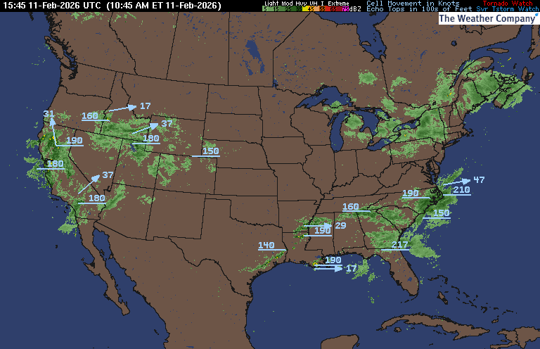
PRECIPITATION TYPE (CLICK TO ACCESS ANIMATION FEATURE)
CARIBBEAN RADAR (CLICK IMAGE TO ACCESS ANIMATION)
You may direct any questions by contacting me personally, ANYTIME, at: twalsh22000@yahoo.com
Have a blessed day!
T. F. “STORM” WALSH III
GMCS, USCG (ret)
METEOROLOGIST / HURRICANE SPECIALIST /SEVERE WEATHER SPECIALIST


.gif)


 English (US) ·
  French (CA) ·